CropMap
AI-powered parcel-based crop mapping platform using satellite imagery and machine learning to classify agricultural land across Turkey
Country
TR
Time Frame
2023 - present
Industry
Agriculture & GIS
Project Type
Web Application
Services
AI-Powered Crop Mapping, Parcel Detection, Satellite Image Processing
Technologies
Python, JavaScript, MongoDB, HTML, CSS
About the Project
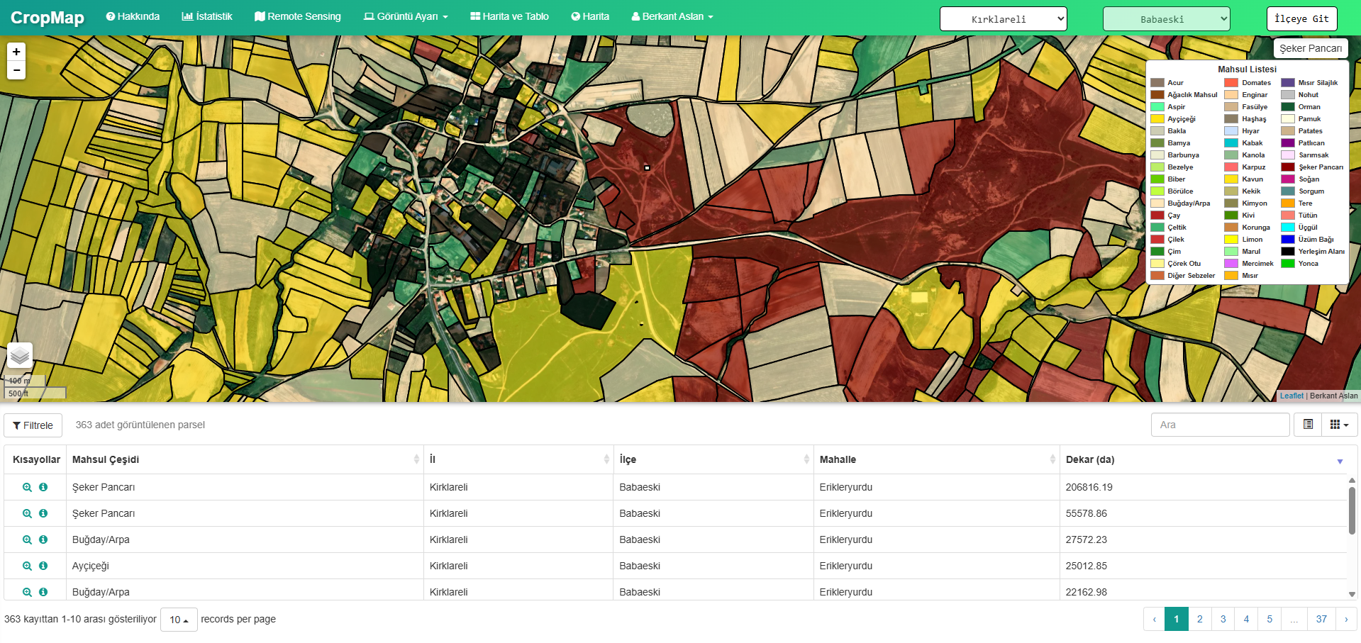
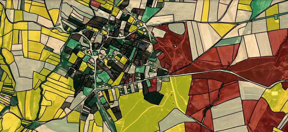
CropMap is an agricultural mapping platform that uses Sentinel-2 satellite imagery and deep learning to automatically detect and classify crop types at the parcel level. It enables farmers, agricultural planners, and government agencies to monitor land use across entire districts with high accuracy.
Key Features
- Automatic parcel boundary detection integrated with Turkey's land registry (TKGM)
- Multi-class crop classification using deep learning models trained on Sentinel-2 imagery
- Filterable interactive map with parcel-level statistics and historical time series
- District and province-wide coverage with real-time data refresh
 After
After Before
Ready to start your project?