Remote Sensing
Satellite-based vegetation index monitoring platform providing real-time NDVI and NDMI analysis for agricultural parcels
Country
TR
Time Frame
2023 - present
Industry
Agriculture & Remote Sensing
Project Type
Web Application
Services
NDVI/NDMI Analysis, Satellite Image Visualization, Land Use Monitoring
Technologies
Python, JavaScript, MongoDB, HTML, CSS
About the Project
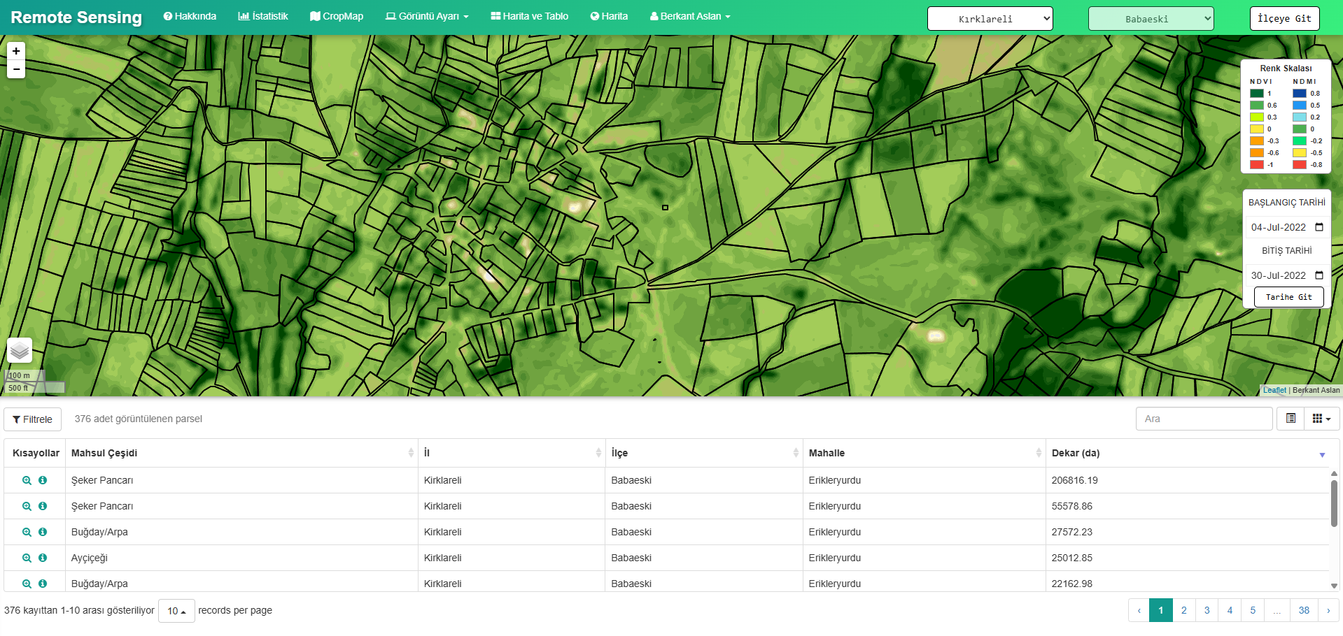
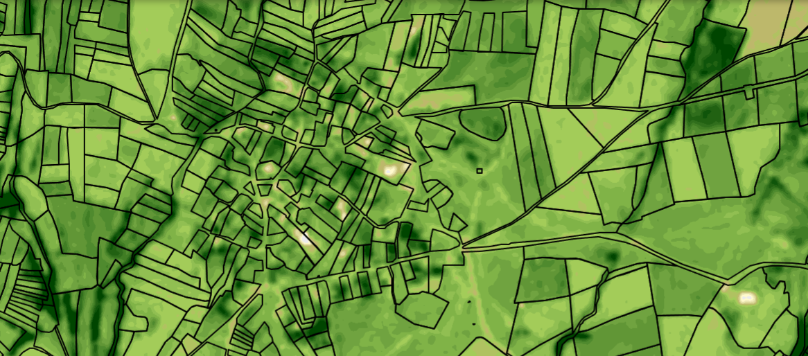
Remote Sensing is a vegetation monitoring platform that processes Sentinel-2 multispectral satellite images to compute NDVI and NDMI indices over registered agricultural parcels. Users can select any district in Turkey, set custom date ranges, and instantly visualize crop health, moisture stress, and yield forecasts on an interactive map overlaid with cadastral boundaries.
Key Features
- NDVI and NDMI index calculation from Sentinel-2 multispectral bands
- Interactive map with cadastral parcel overlay and date range selector
- Crop health and moisture stress visualization with color-coded legend
- Time series analysis and historical comparison per parcel or region
 After
After Before
Ready to start your project?